Yesterday’s adventures left me wanting to explore the area of the Black and White Path further, and Rich was amenable to spending some more time reading and relaxing at Bear Brook picnic area while I poked around on the mountain. The day began mostly cloudy and just slightly cooler than yesterday.
First, as always, some breakfast. Today’s choice was bagels from A Slice of Eden bakery down on Cottage Street. Rich chose his favorite, a whole wheat bagel with veggie cream cheese, and I had an everything bagel with spicy lime-cilantro cream cheese (they had run out of my most favorite olive-pimiento cream cheese, but this one is a close second). I brought the bagels back to eat on the porch, as usual, and we also brought over some coffee, tea, and juice from the hotel lobby.
We headed over to Bear Brook just after 9:00am. The area was deserted, which we hoped portended a much less busy day than yesterday was. (Fortunately, it did indeed turn out that way.)
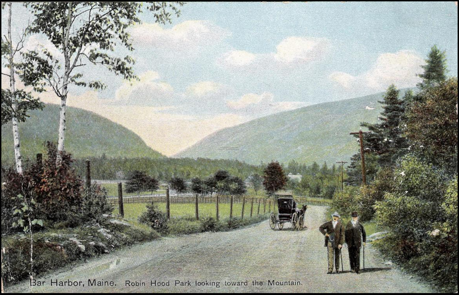
Before approaching Huguenot Head and Champlain, I wanted to explore the wooded area near the picnic grounds one more time: this time to search for a series of old wooden fence posts that several local history bloggers claim were once part of an old park with a racetrack—Robinhood Park, circa 1900—in this area.
Robin Hood Park
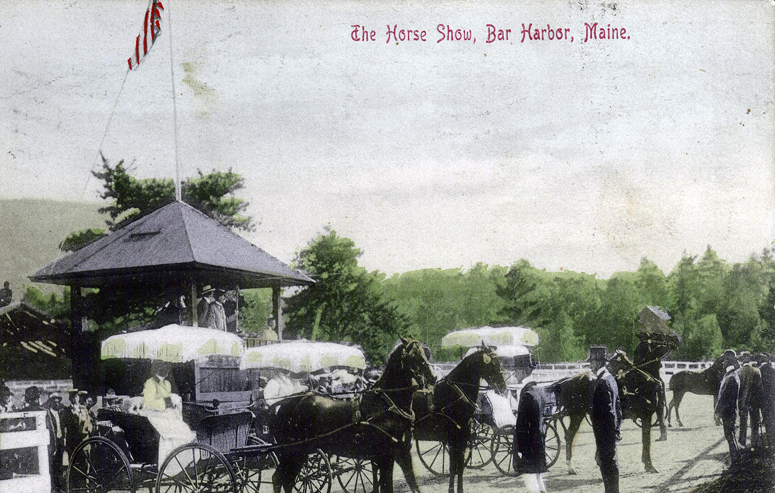
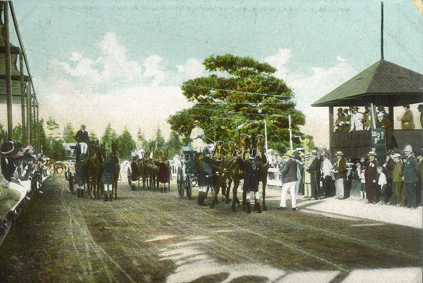
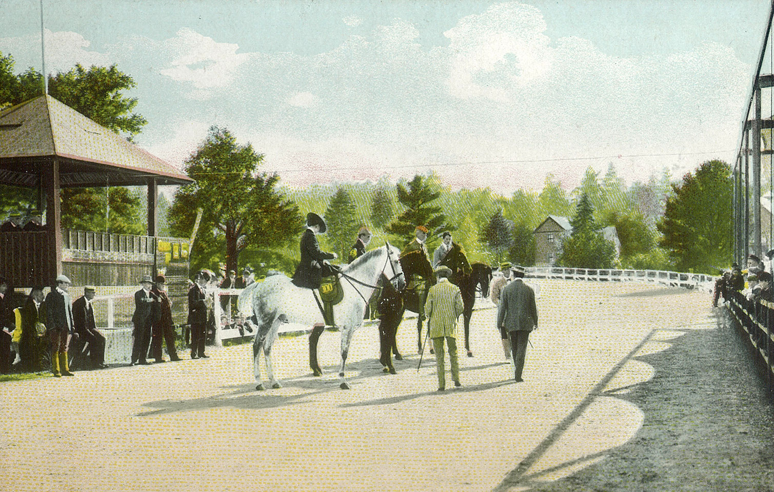
The land where Jackson Laboratory now sits was once owned by Edward de Veaux Morrell, a Pennsylvania lawyer and U.S. Congressman (and brother-in-law to Saint Katharine Drexel). He purchased the sixty-acre property, called Robin Hood Park, in March 1898. The grounds contained a half-mile track for horse racing.
In 1900, according to the Maine Memory Network, Morrell made the park grounds available for use by Bar Harbor's newly-formed Horse Show and Fair Association. Horse shows were held there for three days each August from 1900-1912.
Last year, we located a memorial plaque alongside Route 3, on the current Jackson Laboratory campus, dedicated to Morrell.
This year, as you'll read below, we spent some more time exploring this small, hidden, but quite historic area.
The area is swampy and boggy and quite heavily overgrown with tall grass and sweetfern, but I was easily able to reach the coordinates I had obtained from my research. I didn’t see any of the wooden posts I was expecting to see at the site, however. I looked around closely and noticed that someone has been doing quite a bit of drainage work in this area, as there was a trench dug (right where I expected to find the fence posts, actually) and some new black plastic pipe of various diameters lying along the ground. Also near the coordinates, I found a stone fire ring which was possibly an interesting relic of the old Bear Brook campground on this site. There is no way to know for sure how old it is.
I walked a little closer to the Park Loop Road and found an old road grade. I really enjoy finding these! They are so obvious when you’re on them, and sometimes even from a distance, no matter how much they have been reclaimed by nature. I even found a few pieces of broken-up asphalt as I followed the road grade to the east. It will be interesting to research what this road was.
As I was walking around in the area, I spotted two survey rods with plastic caps that said ACADIA on them. And in line with those survey rods, I finally spotted what appeared to be one of the wooden fence posts!
This encouraged me to look around a little more, and after a few minutes I spotted two more of the fence posts. I couldn’t find any others in the area. They may have fallen over (the last two I found were leaning over at a sharp angle) or may even have been removed during the drainage work.
While on my way back to the picnic area, I spotted another NPS boundary marker. This one is just a stone monument, with no disk or drill hole.
Back at the picnic area, I sprayed my legs with bug spray before heading back into the mosquito haven that is the area of the Black and White trail!
I walked to the western end of the Bear Brook parking area, planning to cross the Park Loop Road and walk back about 90 feet to enter the woods at the spot where I entered yesterday, heading toward the bicycle path. But to my surprise I saw another trail right in front of me, leading off into the woods. I began following it, at first expecting it to just curve around and meet up with the other trail. But to my surprise it headed away from the other trail, to the southwest! It was a very obvious and well-used trail. It was short and led me right to the Beechcroft Trail, an officially maintained trail of the national park.
This seemed like a great opportunity to do what I originally had planned: get to the top in any way possible, and then search for the trail on the way down. In addition I was thrilled to hike a beautiful trail that I haven’t done in a few years.
This worked out well. As I approached the Beechcroft Trail, I spotted a hiker climbing up, so I stayed back until she passed, so as not to give away the location of the unmarked trail. I popped out onto the trail and began taking a few photos, when another hiker approached. He was an older man who at first said he would hang back so I would take my photos without him in them. We then started talking for a few minutes. I learned that he has been coming to Acadia since the early 1970s and, like us, finds it a perfect spot to relax and enjoy something new each time. His name was John. I told him a little bit about my website and was wishing that I had a business card to give him, so he could visit this website if he was interested in more details on our historical research and explorations.
I continued on. John and I crossed paths once more a little further up the Beechcroft Path, and one or two other hikers passed by in the other direction, but overall the path was nearly deserted today. The beautifully constructed stone staircase path winds around in many tight switchbacks as it climbs Huguenot Head. Once it levels out, circling just below the summit (the current path does not reach the summit of Huguenot Head) there are a few swampy areas in which I spotted a frog (too bad I didn’t have that telephoto lens today). Just a few hundred feet past that point, I reached the obvious 4-way intersection with the path that goes down to Route 3 (#341 in Pathmakers) and the Black and White heading north.
Let’s see if it’s easier to find this trail from the top!
Spoiler alert: it’s not!!!
The beginning was promising, with what looked like an actual path through the woods, but after 100 feet or so it devolved into the same sort of water erosion drainage channel nightmare that I encountered on the way up. There are so many deeply eroded channels that it’s hard to imagine how you could ever spot a path in here even if there was one. I spotted a few random cairns here and there that seemed to indicate that the main drainage was the correct path, but it’s hard to tell. I suspect (and think I read) that the original path wove back and forth across the brook and the fall line of the slope. But I saw almost no indications of a true old path here … until …
I was trying to navigate down the steepest, by far, part of the brook. While water wasn’t flowing, everything was still very wet, and it was the type of terrain where there are big chunky rocks resting against each other at odd angles, all covered with wet moss and lichen that are more slippery than ice. I picked my way down, down, down over these rather terrifying surfaces, one very tentative footfall at a time, deciding to cross to the other side at one point … and emerging at another beautifully constructed, very long, stone staircase leading right up alongside the steepest part of the hill!
This was such an exciting find. I had never before heard about any steps or staircases on the Black and White trail. Honestly, there isn’t much information available at all about the trail, and while Pathmakers typically mentions constructed features in their trail inventory, they said nothing about the staircase (I have to wonder if they aren’t even aware of it).
Additionally, JR Libby’s blog mentions that he hiked the trail once many years ago. He mentions the randomly placed cairns but says nothing at all about this huge staircase that is still in excellent condition.
Anyway, I was only a few hundred feet from where I turned around yesterday, so I made the connection easily and headed back to the picnic area. Rich and I had been trying out the radios along the way, and they seemed to work really well on the downslope but not at all, as we figured, when I was on the other side of the hill heading down toward Route 3.
It was a great adventure and so exciting to find the staircase. Now I’m wondering if I can find out more about that trail and its construction. I will keep looking! Too bad that overall, this isn’t a great place to hike. It could have been a nice easy way to approach to Champlain and Huguenot Head, but as it is, the terrain is treacherous and not too pleasant to traverse.
We were both a bit afraid to admit that what we were really looking forward to for supper was the same thing we had last night: a small house veggie pizza at Rosalie’s, and two large beers. It seemed like the right thing so we went for it. After finishing the small pizza, our “dessert” was a slice of stuffed chicken, broccoli, and cheese pizza that we shared. That was really good, and “stuffed” us for the rest of the night!