Today’s breakfast was at Jeannie’s again: we really can’t get enough of that place this year! It’s friendly and inviting, open early, and even though it’s always busy, service it great so things move quickly. This morning I enjoyed two wild blueberry pancakes and orange juice, and a few sips of Rich’s coffee. Rich had two egg and cheese sandwiches with bacon and a side of home fries (he must have been extra-hungry!).
After breakfast, we headed to the western side of the island for a bike ride. Along the way, of course, we searched for two NGS benchmarks (PE0303 and PE0304, neither of which we found) near the amusingly-named Pork Chop Lane.
Hio Fire Road
Today’s ride took us along the old Hio Road, located near Seawall Campground. This old double-track fire road is only about two miles long, but its isolation and lush green beauty made it a perfect retreat for us. The road is lined with thick moss and ferns, and the smell of balsam was in the air as we rode along the road’s sun-dappled gravel surface.
At one point along the old road, Rich spotted an orange witness post and a granite monument, very similar to the other NPS boundary markers we’ve found, but this one sported only a drill hole - no disk.
I followed the property boundary into the woods and found another granite post, again with no disk. There were, however, three blocks of wood fastened to the ground around the post, forming a triangle. It was very, very buggy in this location!
The bike ride was only the beginning of today’s adventures. Next, we thought we would try to search for a nearby topographic station.
Most of the topographic stations in this area are on practically inaccessible islands (we don’t have a kayak—or a helicopter!), so we haven’t been able to recover many of them. One called LOP looked like a strong possibility, though, and one I’d been interested in for a few years already.
LOP and DUKY
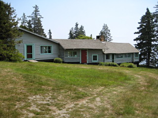
Driving south on Lopaus Point Road, we could tell that we might have an issue with all the private property nearby. In fact, there were so many “private drive” signs that we began to feel uncomfortable, so we parked the car and walked the remaining half-mile or so toward the coordinates. While we walked, a woman in a Subaru passed us, heading out toward the point, but said nothing. When we reached the end of the road we came upon a neat house that looked like three cabins strung together. The Subaru was parked there. We approached the cabin to ask permission to search for and document the mark.
The woman answered and immediately called a man to the door. He was extremely kind and pleasant, and he had no problem with our going to document the mark. As we’ve found with so many landowners, he was aware of the survey mark but had no idea of its purpose or history. We were happy to provide this information for him and to show him the datasheet while we chatted. Our private nickname for the residents became “The LOPsters,” for obvious reasons.
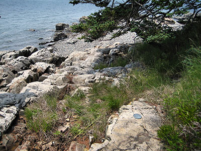
We found the mark easily on some ledges along the shore. It’s in excellent condition. But while I was taking my photos, I apparently disturbed a nest of biting ants! They had swarmed up my legs and were biting all over. I did an “ants in the pants” dance for sure! Even after we were done with our recovery and were walking back to the car, I found a few still roaming around inside my jacket.
After our adventures searching for LOP, we drove directly to Dix Point, also on the southwestern side of the island, to search for DUKY. Similar to LOP, there was a cabin on the point near the mark that we would have to pass by in order to reach the shore. No one appeared to be at home, and no vehicles were parked at the site, so we quickly and quietly sneaked through the woods down to the rock ledges along the shoreline to search for the mark.
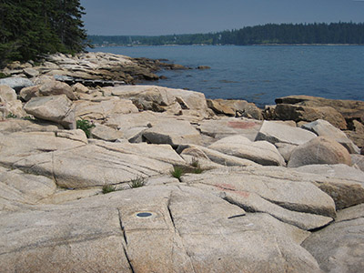
The adjusted coordinates made this topographic station a quick find—a bit of a shame, really, because this is such a beautiful location! It would be perfect for a picnic lunch and a reading session or a nap in the sunshine. But there’s that problem of trespassing, which we technically were engaging in, so we took our photos and left the area without much delay.
I enjoy finding these topographic station marks. They’re out of the ordinary and are also usually in pretty coastal locations. DUKY is in very good condition. I do wonder where the designation came from. There is a Duck Cove nearby, but it’s the next cove to the east (the cove nearest DUKY is Goose Cove).
Bass Harbor Head Lighthouse and Wonderland
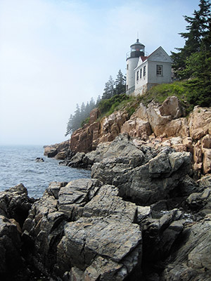
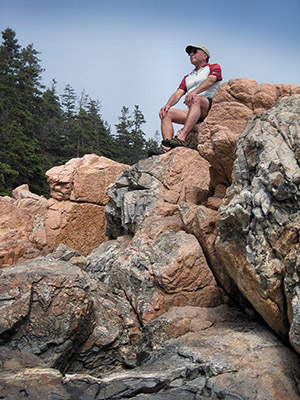
In case you thought that was enough for one day, we followed up these station recoveries with a drive over to Bass Harbor Head to check out the lighthouse and hang out on the rocks for a while. Believe it or not, we found yet another NPS boundary marker on the way! It’s located in the southeast corner of the intersection of Lighthouse Road, which heads south toward the lighthouse, and Arnold Road, heading east. Like many others we’ve found, this NPS disk is unstamped, and is set into the top of a granite post.
Somehow we had enough energy for one more hike - at Wonderland, an easy shoreline trail about a mile east of the lighthouse. We saw white and pink beach roses lining the trail, and bunchberry flowers in various stages of turning into bunchberries proper. While we were hiking, mist rolled in and it got cold very quickly. This was our cue: today’s adventures were coming to an end.
… and a feast
At some point during today’s adventures, we decided we were in the mood for dinner at Havana. When we returned to our room in the afternoon, we called and made reservations for 6:30pm. And it was worth the wait and the huge appetite we had worked up!
Havana always serves a basket of delicious bread before the meal, which we enjoy with mojitos. The basket contains a few slices of whole-grain bread, usually some French-style bread, and cornbread that is always different. Tonight’s cornbread contained sweet potatoes and green onions, and was served with orange honey butter. I really liked it.
We shared two appetizers: lettuce wraps filled with carrot and spicy crab meat, and mushroom spring rolls (assorted wild mushrooms, Japanese wheat noodles with mirin soy reduction and roasted corn poblano aioli - best appetizer ever!). We then shared a bowl of hot & sour mushroom soup with a turnip base.
And if that wasn’t enough, we still had our entrees to look forward to. Apparently we were in the mood for “beast” tonight as we had the Argentinian-style skirt steak (served with papaya chimichurri and Peruvian potato salad, and topped with thinly sliced onions) and the filet mignon verde (served with spicy tomatillo salsa verde, and served on top of whipped potatoes with spinach and blue cheese).
It may sound excessive, but Havana’s portions are reasonable, and the food is so delicious and well-prepared it’s hard to skip any courses! We even had dessert, which was just a simple scoop of local blackberry ice cream.
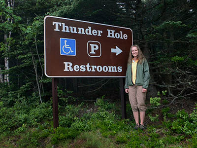
We finished up our very active day with a drive through the park at night, finding appropriate hilarity in the “Thunder Hole Restrooms” sign!
