I wish we visited Big Pocono State Park, centered around Camelback Mountain, more often. Despite its beauty, for some reason it just doesn’t usually come to mind when we’re considering places to hike and explore. Today, though, we had two quests in mind: to complete my recovery of the CAMELBACK tri-station from four years ago, and to search for another tri-station in the area, TANNER.
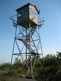
After photographing the fire tower (LY2687—a landmark station that I’ve recovered before, but it was a new find for Rich), we moved on to the CAMELBACK station.
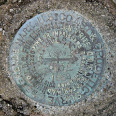
We reached the main station disk with little difficulty once we found a way through the rocks and brush in the area. The disk is not stamped, and it has seen better days. It has suffered some weathering as well as possible vandalism. RM 1 was also an easy find, probably because I’d been there before. But RM 2 was a different story. At the time of my first visit, I had been unaware of the datasheet “box score” and was merely following the written directions on the datasheet, which place RM 2 west of the fire tower. Today we discovered that it’s actually east of the tower—so I was searching on entirely the wrong side! We found the mark easily once we recognized the mistake that had been made.
Ahh, those ever-alluring, highly elusive “never been recovered” tri-stations … at least in the case of TANNER, it appeared, based on our topo map, that trails and woods roads would take us almost right to the spot. You can guess that’s not what happened.
Our plan was to take the South Trail and then the North Trail Lower Loop east from the summit down the side of the mountain in the direction of I-80. Just before its easternmost point before the North Trail begins its curve to the north, our topo map (but not the park map) shows a trail or woods road branching off to the east-northeast and then, after a switchback, heading more directly east toward TANNER on a knoll overlooking the highway. We never found that branching-off point, even though we had prepared some potential coordinates ahead of time. The laurel was just too thick to fight our way through, at least not without a really good idea of where the trail/woods road actually was.
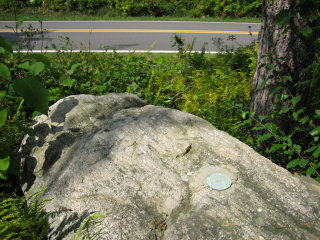
We were so beat up by the time we emerged back on the summit; typically that would signal the end of all activities for the rest of the day (except, perhaps, stopping for a beer and snacks somewhere). Today, we decided to search for the CAMELBACK azimuth mark—but it’s not as bad as it sounds. According to the description the azimuth mark is conveniently located right along the road down the mountain—on our way out of the park. We drove slowly, seeing nothing exciting for a few minutes. Then I spotted a large boulder off to my left, and immediately stopped the car and hopped out. It was a long shot, and I was surprised to see the azimuth disk sitting right on top of the boulder! Finally my quest was complete. Like the reference marks, the azimuth mark disk was in good condition with legible stamping.


