Story and photos by Rich
Saturday morning saw Zhanna, Aaron and Rich departing Jessup at 7:30am for the East Hudson Highlands. Target area for today’s hike: Bull Hill (Mt. Taurus), NY. Trails here are moderately steep and very rugged. Thick and loose leaf cover made footing a bit tricky in the washed out, rockier sections. This nearly 6-mile circuit hike climbed 1200 feet from the parking spot on Rt. 10 to the summit, with additional elevation gains and losses along the entire route.
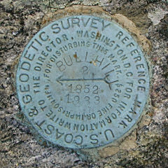
The loop they followed crosses the underground Catskill Aqueduct twice. A half-dozen lookout points offered stunning views with unique perspectives both to the north and to the south. Not quite as dramatic or as panoramic as those found on Storm King Mountain, but noteworthy nonetheless. Thick haze obscured scenes on the distant horizon to the north. In addition to lunching and napping at one particularly busy and noisy outcropping ledge, the three weekend adventurers found two geocaches and recovered one NGS tri-station (its two reference marks were intact, but the station mark had been pried out, obviously stolen [Bastards!]).
Temperatures were in the upper-60s and low-70s, with mostly sunny skies in the morning, turning partly sunny in the afternoon. What a spectacular early-November day! No wonder so many other hikers were out on the trails today.
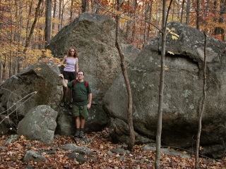
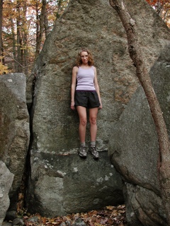
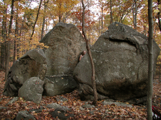
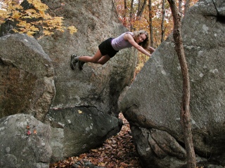
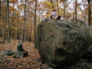
As usual, everyone’s focus was mostly on enjoying the weather, the scenery, and each other’s company, so the photo-taking ended up being a sort of neglected afterthought, except for some horsing around snapshots that Rich had managed to capture in the fading daylight while Zhanna tried her hand (and foot!) at a bit of casual bouldering.
Dinner was had at a decent seafood restaurant called The Riverside in nearby Cold Spring (a touristy, somewhat Jim Thorpe-ish hamlet on the Hudson).
Today's Geocaches
Bull Hill Junction
- Owner: eagleflyby
- Location: N 41° 26.598' W 073° 57.104'
- Log Type: Found it
- Date: 4 November 2005
- Original Geocaching.com listing
Hi, EFB!
Bull Hill Junction was the first of two of your caches we Northeast PA adventurers found on this beautiful November Saturday. Our day began early: we left home at 7:30am, determined to fully enjoy the forecasted warmth and sunshine, as well as make the most of one of the last weekends before the exceptionally short, dark days of Winter set in. Arriving just under two hours later at the suggested parking area, we followed the rocky blue-blazed Lone Star Trail north, bypassing the Split Rock, and then west to the junction.
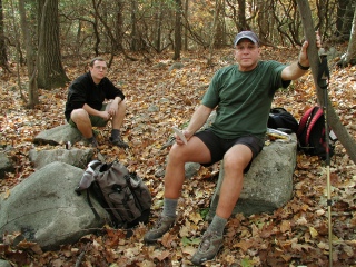
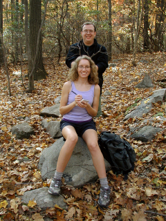
Here we all felt the need for a little break. I turned on my GPSr and we discovered that your cache was conveniently located less than 100 feet away from where we stood. The cache was well hidden, but the coordinates were excellent and the three of us spotted it simultaneously. We had some fun taking photos while signing the logbook, and then I decided to take the tick tweezers (just in case!) in exchange for the homemade signature items left by Rich. A few hikers passed through the junction while we were busy at the cache site, but overall this part of our hike was quiet and peaceful.
After rehiding the cache, we chose the white-blazed Washburn Trail and followed it south toward the summit of Bull Hill, en route to amazing views, an NGS tri-station, and another cache of yours. Thanks for a great start to a lovely mid-Fall day of hiking, exploring, and enjoying the breathtaking views of the East Hudson Highlands. Our story continues at Mt. Taurus!
Zhanna
Howdy, EFB!
Mostly due to the fact that I have a backlog of caches from as far back as June, and also because I’ve been more intent on hiking in new areas, I haven’t been going out specifically with geocaching in mind for the past several months. If there happens to be a cache nearby or along the trail, we’ll usually stop for it, but seldom do we go too far out of our way for them. We’ve tried to limit our focus to the hike itself, and lately we’ve found ourselves very interested in the Hudson Highlands, both the west and east sides of the river. This was our first visit to Mt. Taurus. Zhanna found a hike review on the ‘Net the other day and it sounded interesting enough, and of about the right length for a day-trip this time of year.
We met around 7:30am, arriving about 1¾ hours later at the Lone Star trailhead parking area off Fishkill Road. The sun was shining brightly, temps cool but warming, and the air calm. The weather was already looking awesome for early November. Our goal today was a 6-mile circuit hike to the summit of Bull Hill (~1200 feet above the parking spot!) via the Lone Star, Washburn, Undercliff, Nelsonville and Split Rock trails.
Zhanna had brought cache description printouts for several of the nearby caches as well as for the NGS tri-station, and she had preprogrammed her GPSr with the coordinates so that we could quickly locate these points along the way. At the junction of the (G) and (W) trails (we now have all of the NYNJTC maps), we took a rest break and looked for the first cache. This one was an easy find. The container was well hidden, and everything inside was in good condition. After signing the logbook, I left a couple of my signature geo-magnets in exchange for the tweezers/magnifier, which I gave to Zhanna to keep in her backpack. We snacked a bit while goofing around for snapshots. Then it was back to the trail, and onward and upward. So far, we were enjoying the hike and the area immensely!
Thanks for placing this cache and adding to our day’s adventures.
(This tale is continued in my log for your Mount Taurus cache.)
~Rich in NEPA~
Mt. Taurus
- Owner: Eagleflyby
- Location: N 41° 26.271' W 073° 57.341'
- Log Type: Found it
- Date: 4 November 2005
- Original Geocaching.com listing
Hi again, EFB!
This was the second and final geocache of the day for Aaron, Rich and me. As we’ve done several times throughout this Summer and Fall, we spent the day in the Hudson Highland region, exploring and climbing to rocky overlooks with incredible views along the river. After locating your Bull Hill Junction cache, we followed the white trail toward the summit of Bull Hill, stopping here and there for views of Breakneck Ridge, the Shawangunks and the Catskills beyond (which unfortunately were obscured by haze). My companions were prepared for a short rest period (or a few minutes of boredom) while I recovered the NGS tri-station BULL HILL RESET. Rich aided in the recovery while Aaron fended off questions from overly curious kids passing by.
Approaching the most scenic and most popular overlook, where we’d planned to nap for a while and share a picnic lunch, we heard (and then saw) several girls already on the rocks. Luckily we were in a good position to take our time, find the cache first, and then enjoy our break with the hope that we’d have some solitude by the time we reached the ledge. The cache was easy to find, if a little slippery to get to, and everything inside was dry and in good condition. Neat, unique container! Rich left some of his special signature geo-magnets, and I took the cat stickers.
We enjoyed our lunch of pizza, cheese sandwiches, fresh roasted pumpkin seeds and other assorted snacks on the rocks, and then attempted to take a short nap in the sunshine. Soon, though, the peace was broken by advancing hordes of teenagers and young adults who insisted on bringing the city to the mountain. Why is it so hard to leave your cell phone turned off for an afternoon?! Outnumbered, we soon left in search of quiet ledges further on down the trail, which we did find. By this time, though it was getting later in the afternoon and we wanted to avoid coming out of the woods in the dark. Our plan was to take the yellow-blazed (poorly blazed, as we found out) Undercliff Trail to the Nelsonville Trail, then follow this over the path of the Catskill Aqueduct to the Split Rock trail. I had a great time playing at the rock, climbing all over it and pointing out its interesting natural features as well (“Hey! Is that the Virgin Mary?!”). Worn out and ready to eat, we soon headed back down the short section of the Lone Star trail toward the car and then to Cold Spring for a well deserved dinner of ravioli, fish stew, and braised short ribs at The Riverside.
I’m afraid this may have been our last Hudson Highlands day trip for this year, but we’ve only just started exploring the many fascinating historical and geological areas in this region. We’ll be back many times in the future. Thanks for the introduction to Bull Hill!
Zhanna
Howdy, EFB!
Continuing our climb to Bull Hill summit from your Bull Hill Junction cache, we made sure to stop and spend sufficient time at each of the overlooks. The views were fabulous despite a thick haze on the distant horizons.
Upon reaching survey tri-station BULL HILL RESET, Zhanna, our resident Queen of Benchmarks, did a full recovery of the station and will shortly be submitting an official report to her contacts at NGS. As a side note, since the station mark itself is missing, there’s a likely chance that NGS will reclassify the station as either “destroyed” or in “poor condition.” Such a shame that some people have to be so thoughtless and uncaring about these priceless and historic National treasures!
Our next goal was to search for the cache. Once again it was an easy find. Didn’t need the hints. And by the way, that’s quite an unusual container, but it seems to work well! We found it appropriately hidden; its contents in good shape. I left two of my signature geo-magnets, took nothing, and signed the logbook.
From the cache site it was a short scramble to a large outcropping ledge with a gorgeous view to the south. This is where we decided to have our picnic lunch and take a quiet little nap while laying in the warm sunshine. However, it quickly became apparent that this spot is very popular: a lot like Grand Central Station, I’d say!!! It was bustling and noisy today. We hung out there for about an hour or more, then figured we’d better keep a close eye on the time needed to complete the loop back to our car.
We continued following the Washburn trail west to it’s intersection with the Nelsonville trail. For the most part, the Nelsonville trail is rather poorly blazed, and keeping to the trail took considerable concentration and sharp eyes. The thick layer of fallen leaves only obscured whatever worn pathway there may have been. Aaron, our Indian tracker/guide, was of great assistance here! Once we reached the woods road section, things got easier again. It was already getting late in the day. Zhanna had the printout for the Undercliff cache, but once we realized that it was a multi-stage affair, we decided to pass on it for another trip. At Split Rock we played around for a while, taking photos and doing a little casual “bouldering,” totally unaware that there was yet another cache within spitting distance! Oh, well … we’ll get it next time too. We finally returned to the car with only a little daylight left to spare.
Of course, no day-trip of ours would be complete without a stop for dinner at a good restaurant. After all, the only reason we hike at all is for the food, right?! The nearby town of Cold Spring seemed to be attractive and touristy enough to have its fair share of nice places to eat. We chose a little restaurant/bar called The Riverside which, as its name suggests, is very close to the Hudson. Hence it was a very fitting end to a very memorable day!
~Rich in NEPA~
