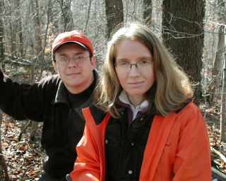
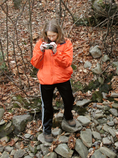
The day started out sunny and mild, and after a few minutes of hilly hiking I was beginning to wonder if I’d dressed a little too warmly. Not to worry, though, we quickly cooled off in the creek! Our attempts to bridge the stream were quite spectacularly unsuccessful, so the boots and socks came off and we hopped into the arctic flow. I’ve waded through streams before, but never so late in the year. One step in the water and my feet—especially my recently broken toe—were exploding with pain. Fortunately it was short-lived.
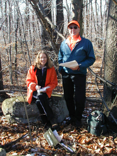
Soon afterward we began the true climb up The Stack, fighting thorns and trying to keep our balance on slippery leaves, and I was warm again. Once we reached the top we found the geocache (“The Stack”) without delay, and took it to nearby boulders where we relaxed in the sunshine for a few moments and ate our lunch. What a comfortable and cozy place! There was just a light dusting of snow left on the ground in spots.
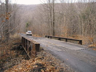
Our trek back to the car wasn’t quite as steep (though I think we ran into more briars) and this time we were able to avoid the creek crossing altogether. We took a slightly different route and emerged on the road to the southwest of the creek, which this time we crossed easily on this old railroad bridge. (Yes, I felt embarrassed.)
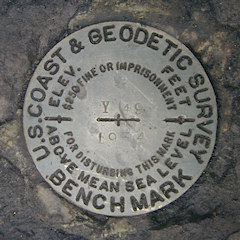
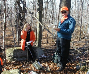
Our first inspection of the bridge abutments revealed nothing but plentiful brush that needed to be cleared, so we returned to the car for tools. Rich was in the process of clearing the brush when a ranger appeared behind us. He asked gruffly whether we were “cutting down trees in the gamelands” but we assured him we were only clearing a small area on the bridge abutment so that we could find and photograph the mark. He was not very interested in our explanation of the history and importance of benchmarks, and he soon left us alone.
We had a fantastic morning on The Stack, and returned home to plenty of turkey and fixings. This is the way all of our holidays should be spent!
Today's Geocache
The Stack
- Owner: IMLost
- Location: N 41° 23.219' W 076° 09.275'
- Log Type: Found it
- Date: 27 November 2003
- Original Geocaching.com listing
Hi, IMLost!
I have very little to add to Rich’s story. ![]() My experience was very similar to his. The day started out sunny and mild, and after a few minutes of hilly hiking I was beginning to wonder if I’d dressed a little too warmly. Not to worry, though, we quickly cooled off in the creek! Our attempts to bridge the stream were quite spectacularly unsuccessful, so the boots and socks came off and we hopped into the arctic flow. I’ve waded through streams before, but never so late in the year. One step in the water and my feet—especially my recently broken toe—were exploding with pain. Fortunately it was short-lived. Soon afterward we began the true climb up The Stack, fighting thorns and trying to keep our balance on slippery leaves, and I was warm again. Once we reached the top we found the cache without delay, and took it to nearby boulders where we relaxed in the sunshine for a few moments and ate our lunch. What a comfortable and cozy place! There was just a light dusting of snow left on the ground in spots. I took the Rat Fink travel bug and added a Star Wars Lego set to the cache. Our trek back to the car wasn’t quite as steep (though I think we ran into more briars) and this time we were able to avoid the creek crossing altogether. Our return route took us right over the old railroad bridge whose abutment holds LZ0103, so we searched for and located that benchmark before heading home. We were approached by a curious ranger who was initially concerned that we were “cutting down trees in the gamelands”, but we bored him sufficiently with our explanation of the different kinds of marks and he questioned us no further. Thanks for providing a terrific adventure for three friends to share on Thanksgiving morning. This is the way all holidays should be spent!
My experience was very similar to his. The day started out sunny and mild, and after a few minutes of hilly hiking I was beginning to wonder if I’d dressed a little too warmly. Not to worry, though, we quickly cooled off in the creek! Our attempts to bridge the stream were quite spectacularly unsuccessful, so the boots and socks came off and we hopped into the arctic flow. I’ve waded through streams before, but never so late in the year. One step in the water and my feet—especially my recently broken toe—were exploding with pain. Fortunately it was short-lived. Soon afterward we began the true climb up The Stack, fighting thorns and trying to keep our balance on slippery leaves, and I was warm again. Once we reached the top we found the cache without delay, and took it to nearby boulders where we relaxed in the sunshine for a few moments and ate our lunch. What a comfortable and cozy place! There was just a light dusting of snow left on the ground in spots. I took the Rat Fink travel bug and added a Star Wars Lego set to the cache. Our trek back to the car wasn’t quite as steep (though I think we ran into more briars) and this time we were able to avoid the creek crossing altogether. Our return route took us right over the old railroad bridge whose abutment holds LZ0103, so we searched for and located that benchmark before heading home. We were approached by a curious ranger who was initially concerned that we were “cutting down trees in the gamelands”, but we bored him sufficiently with our explanation of the different kinds of marks and he questioned us no further. Thanks for providing a terrific adventure for three friends to share on Thanksgiving morning. This is the way all holidays should be spent!
Zhanna
Howdy, IMLost! There wasn’t enough time Tuesday morning for us to do this cache hunt after having found “Big Boulder” so plans were devised yesterday to come back early on Turkey Day to finish up. After a brief stop in Scranton for Team Zhanna & Aaron, I continued the drive down I-81, over to the Back Mountain area, and around through Noxen to the suggested parking area along Bowman Creek. It was a little after 9:00am when we began the trek up to The Stack. That’s when we encountered Cider Run. The water in Cider Run is cold. Ankle-numbing cold! We looked up and down for a decent place to cross and wasted at least half an hour deliberating this significant obstacle before eventually choosing a shallow section to wade across … barefoot. B-r-r-r!!! Oh, and this was the easy part. From here we made a slow and steady climb upward, gaining 765 feet in elevation in roughly three-quarters of a mile. Definitely steep enough to quickly get the me warmed up again. It really wasn’t so bad, though, and I was still feeling as if we were having a terrific time. I think picking our way through some of the thick briar patches was a little worse than the climb itself. We made the summit around 11:00am and then found the cache without much difficulty. While executing our trading and logbook duties we lunched on cold pizza and TastyKake lemon pie. Weather conditions were quite pleasant—mostly sunny, a slight breeze, and temps in the upper 30’s. Except for a few more briar patches, the trip back down was relatively swift and uneventful. We followed a slightly different route further to the south and met up with an old logging track that brought us out onto the SGL road, thereby eliminating another chilly stream crossing. Then it was a short walk to the car. This direction was fortuitous in another way since the old steel plate-girder railroad bridge that spans Cider Run is the setting for a 1934 USC&GS benchmark which we had intentions of searching for after the cache hunt. We spent another hour with the benchmark recovery before returning to our respective homes for well-earned holiday dinners. Thanks very much for such a fine late-November adventure. ~Rich in NEPA~
